Hiking with friends and canines
Rob Bettaso
In recent weeks, I have taken several hikes with pals of mine from the Navajo County Search and Rescue team (SAR). In this article, I will briefly describe two of those hikes: one with Gary and another with John. Gary is among our longest serving and most experienced members of SAR; John is relatively a new-comer; and I am somewhere in the middle, having been a part of SAR for nearly 10 years. It should be noted that none of the recent hikes we took were part of actual SAR “missions” (searching for a lost or missing person) nor were they part of our monthly SAR training outings. Both hikes were simply for the fun of being outside — experiencing nature and enjoying the comradery of like-minded colleagues.
The first outing I will recount was with Gary, with whom I have gone hiking many times over the years. We had decided that we would hike a very popular trail: the Buena Vista, on the Apache-Sitgreaves (A-S) National Forest lands. The reason I had suggested this particular trail (which I have hiked and biked several times since moving to Lakeside) was because I had heard that a “land swap” between the A-S and a private landowner had been such that the nine-mile loop trail was no long do-able, and that the trail now consisted of an “out and back” type of route. Neither Gary nor I were keen on doing an “out and back” so we were considering a cross-country type of return (as a good way to practice our SAR orienteering skills).
When it comes to cross-country hiking, there is no better outdoorsman I know than Gary. From an early age, Gary has spent enormous amounts of time setting off into the hinterlands with some essentials: food and water; basic hiking/survival gear; appropriate apparel; and a map and compass. Given how backcountry navigation has changed with the advent of the Global Positioning System (GPS) and with various “smart-phone” electronic mapping options, Gary has become something of a dying breed: a person who is as comfortable with the old ways (a “7 ½ Minute Quad” — which is a paper topographic map — and an old-fashioned magnetic compass) as he is with the more modern, electronic methods of GPS hand-helds and “smart-phone” apps (e.g. On X, All Trails, Gaia, and the one used by SAR; called SAR Topo).
On the other hand, for me, when it comes to wildland hiking, I generally play it safe and stick to established trails but keep a Garmin (a brand of GPS hardware) and an old-fashioned map and compass close by, just in case. The way I see it, there is a good reason the old-timers coined the term “dead-reckoning” to describe off-trail hiking. Personally, when I’m outdoors, I want to be free to let my mind wander while I hike and not have to apply Daniel Boone’s level of knowledge to get back home safely. Besides, busting through dense vegetation (such as our local manzanita, locust, and/or chaparral) can be physically demanding work. Additionally, when pioneering an off-trail route, one can also find that they have descended into a canyon that “cliffs out,” leaving one to hike back out the way they came; assuming they haven’t scrambled down a series of drops that they may not re-negotiate when they have to climb up and out (Ed Abbey’s harrowing tale from Havasu Canyon back in 1949 comes to mind).
The Buena Vista trail lives up to its name with several impressive views, unfortunately, it is also one of those places that we have “loved to death” — having some deeply rutted sections along portions of the official trail, and many other un-official paths that have been established by unauthorized trail-makers. I still call these informal routes “boot-leg trails,” as I refuse to adopt the term that is used by some people: “social trails.” In my way of thinking, the moniker “social trails” has a potentially positive connotation, and by adopting it, we may have unintentionally contributed to the proliferation of such trails. Conversely, on those rare occasions when I opt to hike “cross-country” am I not also guilty of potentially being the first to lay down a subtle path that others may eventually follow, and encourage the creation of a new “social trail.” Hypocrisy, thy name is Rob!
Because I want to get to my second story, I won’t delve into additional details of our wonderful hike at Buena Vista. Suffice to say, we easily made it from the trailhead on up and across a scenic ridgeline, and then on down to the newly fenced private land. At that point, we traveled cross-country (tisk, tisk) to get back to the trailhead, and we wound up shortening the hike to only six miles — not because we were trying to lessen our mileage, but simply because one never knows for sure how to best proceed along an improvised return. In our case, we wound up taking a few routes that led us into thickets of manzanita, which we opted to backtrack out of, and then we detoured around. Hopefully, the A-S will eventually convert the “out and back” trail into a loop and, as such, will mitigate the odds that we will see the birth of a whole new network of social trails.
My second hike was approximately 20 miles north of the Buena Vista trail. To describe this hike, I would like to traipse down memory lane for a minute, and recall my high-school World History teacher, Mrs. Reed, who would occasionally give us Friday “pop quizzes,” pertaining to what she had taught us earlier in the week. Often, Mrs. Reed would have as a final challenge on the quiz an implied question that would require a short essay response. Invariably, her statement would start: “Compare and contrast...” and would then end with something like “… the city-states of Sparta and Athens in ancient Greece.” So, let me use the Mrs. Reed approach to describe my hike with John — who, along with his spouse Debbie, lives in the Taylor area.
I have already mentioned that all three of us — Gary, John, and I — are members of the Country Sheriff’s SAR team. We also share a deep appreciation of Nature and have an irrepressible need to get outdoors hiking. So much for one aspect of how we are similar, but let us now also look at an example of a respective difference: I augment my hiking with regular mountain bike outings; Gary enters competitive races in cross-country orienteering events; and John is an avid back-country horseman.
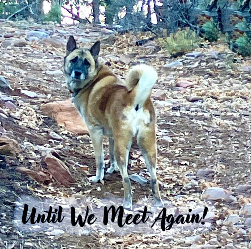
Continuing the study in comparisons and contrasts, it was along one of John and Debbie’s horseback riding routes that John and I set off for our six-mile hike on a recent mid-week morning. John, being a tall person, has a mileage-devouring stride, so I practically had to trot alongside him to maintain my part of our conversation. I wasn’t alone in terms of moving at a brisk clip, as one of the family pups had joined us for the hike. The presence of “Gus” (a mixed breed that is clearly part herding dog) was another difference between my hike with Gary and that with John. Unless I’m seeking skittish birds or other wildlife, I am happy to be in the company of a good natured pooch when walking — and Gus was indeed an ideal hiking companion.
Unlike the clearly identified National Forest lands that Gary and I had hiked in, the land ownership was vague (unsigned/ungated) in the country that John and I did our loop route through. Mostly we followed a sparsely used “two-tracker” path that had a few quad tracks and, of course, lots of horse hoof-prints. Because the dirt road allowed us to walk abreast, we started off our conversation by talking about the family dogs and horses. Learning about horses is always interesting to me since I have never been a horse-guy and know so little about riding or caring for them.
After about a 30-minute crash-course in equine anatomy and physiology (including learning some basics pertaining to the important role of a farrier) John and I turned our attention to discussing current events and the lay-offs of federal employees. Both John and I had worked for the government, with John’s career having included time spent working with the U.S. Forest Service in Arizona and in the private sector (as a forester in the Pacific Northwest and in New Zealand). Additionally, John and Debbie had been teachers in the public school system of Holbrook and it was interesting to hear the details of how John had sponsored many a hiking and trail-running trip in the Grand Canyon, which was often the first time many of the participating Navajo and Hopi kids had seen that magnificent natural world. John, in fact, has spent an amazing amount of time hiking the trails in the Grand Canyon and, in fact, has logged over 3,000 miles within that vast National Park!
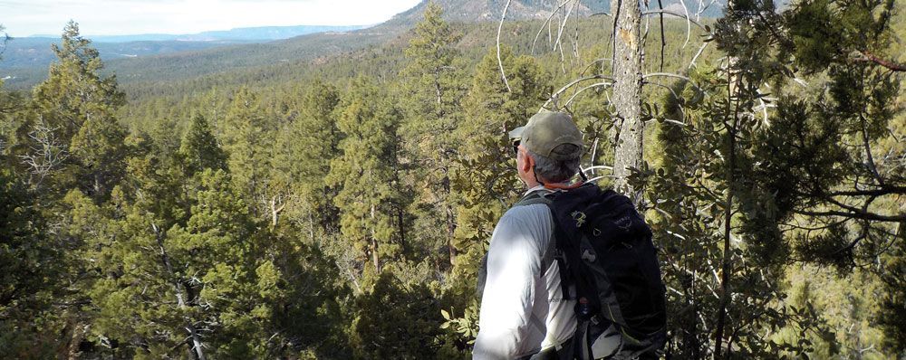
Eventually we left the two-tracker and hiked cross country through the rolling and dun-colored hills near Shoen’s Dam. There were lots of pinyon and juniper trees, but they were not so thick that we couldn’t easily see most of the expansive terrain that surrounded us. It was a beautifully open world, and it felt good for me (my house being situated in dense, tall pine country) to be hiking under such a big sky.
By the time we returned to John and Debbie’s home, classic western clouds (scalloped, but still puffy) had accumulated in the sky, but none of them really looked like they were going to offer any much-needed rain. I had lunch with John while Debbie took ol’ Gus to some kind of dog training in Show Low and after we ate; it was time for me to head home. I was pleasantly tired and felt very much relaxed after several hours of hiking in such wide-open spaces.
So ends my summary of two recent hikes: spending time with two good friends in two very different habitats; enjoying stimulating and meaningful conversations while exploring two different walking conditions. While this winter may be remembered for its minimal snow levels, I will also remember it for having taken advantage of the dry landscape by getting out frequently for excellent hikes with kindred souls.